
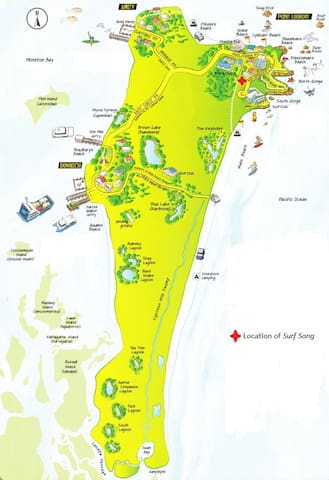
Surf Song Guidebook
Beaches and Lakes
Brown Lake is accessible by conventional cars and provides amenities such as picnic tables, wood-fired BBQs and toilets. To access the lake, drive 4km from Dunwich along the sealed Trans Island Road. Brown Lake is a perfect place to enjoy a swim and picnic lunch. a beautiful swimming area, there are also picturesque walking opportunities on which you might spot some of the island’s wildlife. (No animals permitted)
20 persone del luogo consigliano
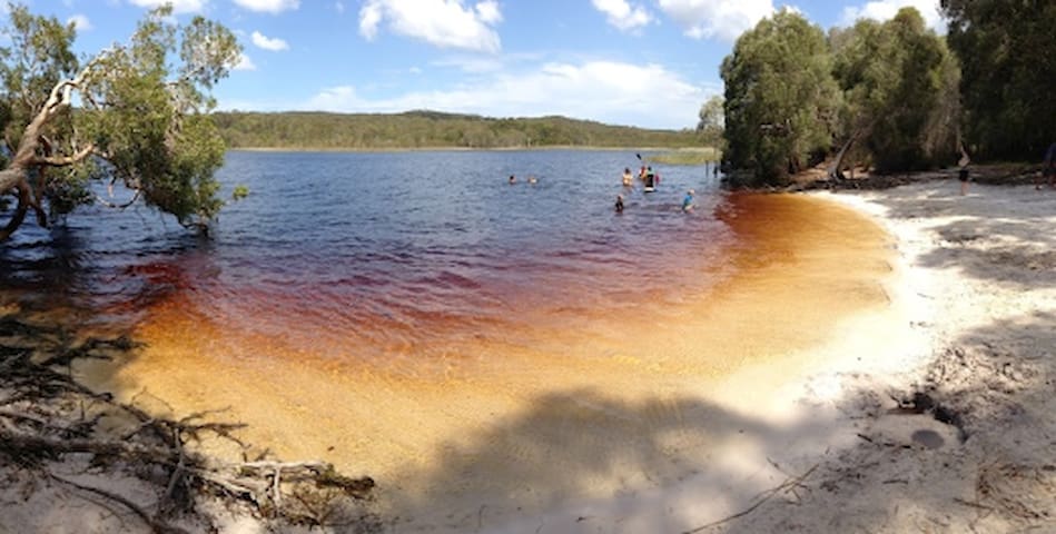
Brown Lake (Bummel)
Brown Lake is accessible by conventional cars and provides amenities such as picnic tables, wood-fired BBQs and toilets. To access the lake, drive 4km from Dunwich along the sealed Trans Island Road. Brown Lake is a perfect place to enjoy a swim and picnic lunch. a beautiful swimming area, there are also picturesque walking opportunities on which you might spot some of the island’s wildlife. (No animals permitted)
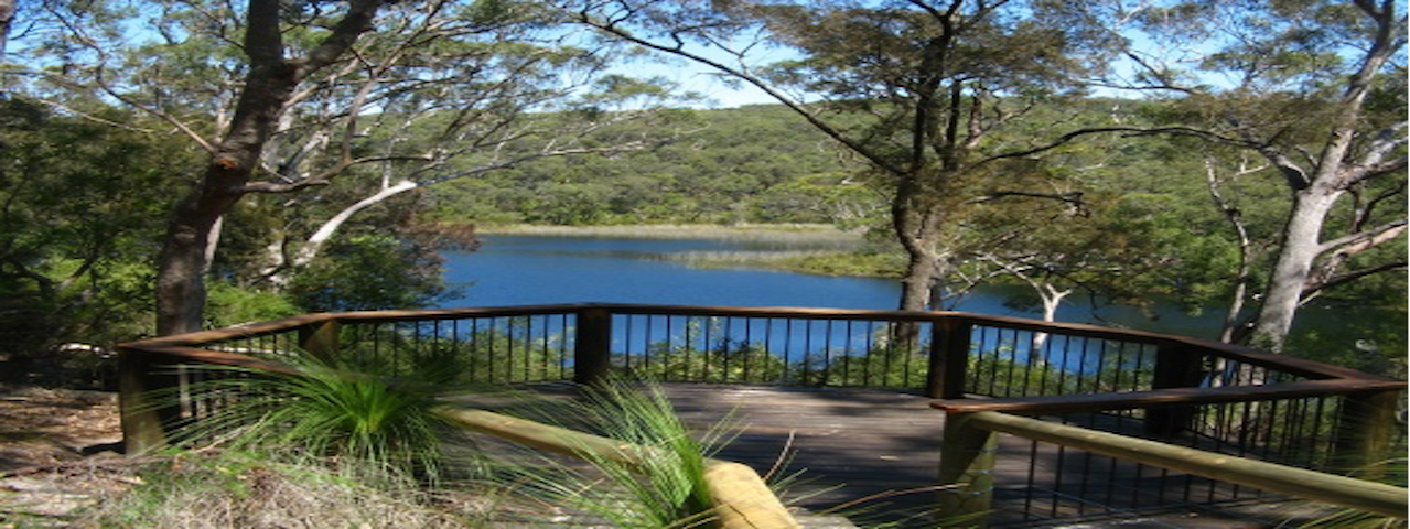
Blue Lake National Park’s Aboriginal name “Kaboora” means “silent pool” and offers a quiet haven (501ha) for visitors to appreciate the natural beauty. Early morning or dusk is the best time to see wildlife such as forest birds, goannas and other reptiles. Blue Lake is not accessible by car, and visitors must leave their vehicles in the allocated car park and walk to the lake, which is approximately 2.6km each way. Don’t forget to take enough water with you for the whole trip, as there are no facilities at Blue Lake.
18 persone del luogo consigliano
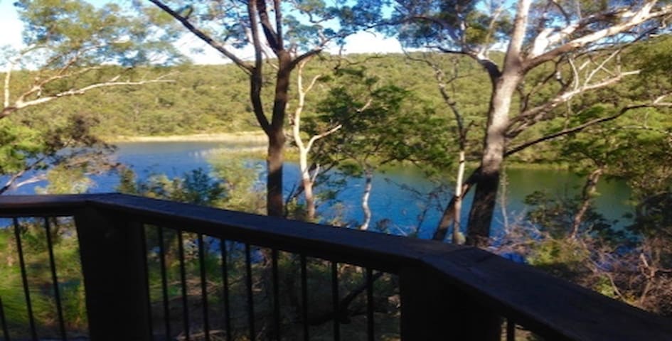
Blue Lake
Blue Lake National Park’s Aboriginal name “Kaboora” means “silent pool” and offers a quiet haven (501ha) for visitors to appreciate the natural beauty. Early morning or dusk is the best time to see wildlife such as forest birds, goannas and other reptiles. Blue Lake is not accessible by car, and visitors must leave their vehicles in the allocated car park and walk to the lake, which is approximately 2.6km each way. Don’t forget to take enough water with you for the whole trip, as there are no facilities at Blue Lake.
Myora Springs. is 5 kilometers along East Coast Road from Dunwich. Myora Springs,is located on the left hand side of the road. These springs have been a source of fresh water for thousands of years and still have an abundance of wildlife in the surrounding forest. There are no toilet facilities or water available.
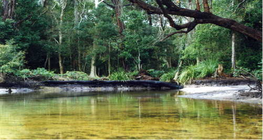
Myora Springs
East Coast RoadMyora Springs. is 5 kilometers along East Coast Road from Dunwich. Myora Springs,is located on the left hand side of the road. These springs have been a source of fresh water for thousands of years and still have an abundance of wildlife in the surrounding forest. There are no toilet facilities or water available.
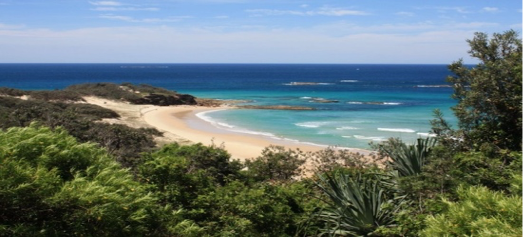
Cylinder Beach is a picturesque cove between Cylinder and Home Beach Headlands. It is popular with families because it is easily accessible with a carpark situated only metres from the beach. The waves at Cylinder are often smaller and therefore it is perfect for sun bathing and swimming during good weather conditions. However during strong southerly winds there is a side sweep which may carry you parallel to the beach.
Cylinder Beach is also a favourite with surfers when the conditions are right.
Lifeguards and lifesavers patrol this beach. Beach Patrol hours: From the commencement of Queensland September School Holidays to the first weekend in May. Weekends and public holidays from 8am – 5pm (Saturday), 8am to 4pm (Sunday), extended hours during peak periods are 8am to 6pm (Saturday) and 8am to 5pm (Sunday). A lifeguard service is provided during the weekdays all year round. Times are subject to change.
21 persone del luogo consigliano
Spiaggia del Cilindro
164 Dickson WayCylinder Beach is a picturesque cove between Cylinder and Home Beach Headlands. It is popular with families because it is easily accessible with a carpark situated only metres from the beach. The waves at Cylinder are often smaller and therefore it is perfect for sun bathing and swimming during good weather conditions. However during strong southerly winds there is a side sweep which may carry you parallel to the beach.
Cylinder Beach is also a favourite with surfers when the conditions are right.
Lifeguards and lifesavers patrol this beach. Beach Patrol hours: From the commencement of Queensland September School Holidays to the first weekend in May. Weekends and public holidays from 8am – 5pm (Saturday), 8am to 4pm (Sunday), extended hours during peak periods are 8am to 6pm (Saturday) and 8am to 5pm (Sunday). A lifeguard service is provided during the weekdays all year round. Times are subject to change.
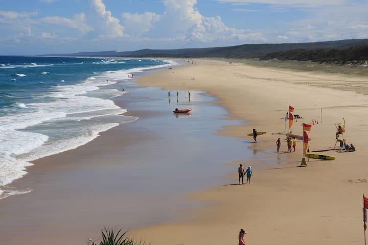
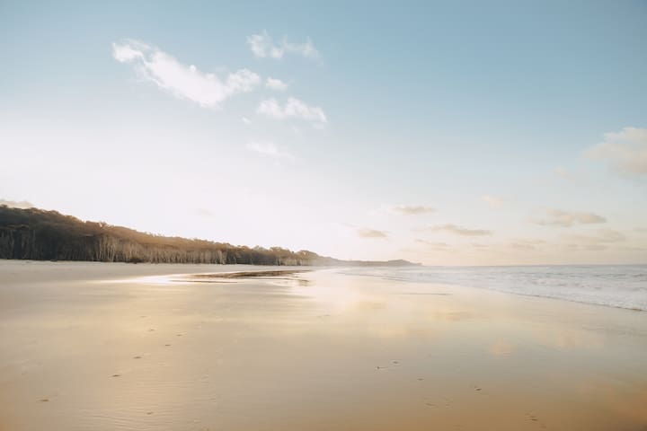
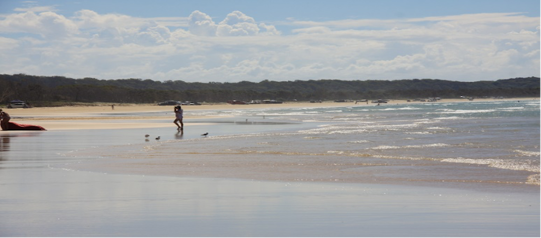
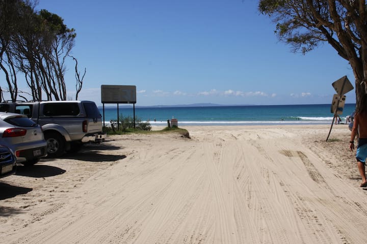
Main Beach stretches for 32kms of unspoilt sand, dunes and surf. It is popular with board riders and bodysurfers who enjoy the big swells. The waves are large and powerful and the views are spectacular. The headland is the best vantage point for watching the surfing action and spotting dolphins. Main Beach is best during northerly winds, when snorkelling and scuba diving are suitable along the north wall. Avoid Main Beach during southeast wind conditions and always be aware of strong rips and side currents. Lifeguards and lifesavers patrol the beach next to the Surf Lifesaving Club. Beach driving is permitted on Main Beach, a 4WD permit is required. Access to Main Beach with a 4WD is from George Nothling Drive, or the Causeway entry off Tazi Rd, Dunwich.
Beach Patrol hours: From the commencement of Queensland September School Holidays to the first weekend in May. Weekends and public holidays from 8am – 5pm (Saturday), 8am to 4pm (Sunday), extended hours during peak periods are 8am to 6pm (Saturday) and 8am to 5pm (Sunday). A lifeguard service is provided during the weekdays all year round. Times are subject to change.
Spiaggia Principale
Main Beach stretches for 32kms of unspoilt sand, dunes and surf. It is popular with board riders and bodysurfers who enjoy the big swells. The waves are large and powerful and the views are spectacular. The headland is the best vantage point for watching the surfing action and spotting dolphins. Main Beach is best during northerly winds, when snorkelling and scuba diving are suitable along the north wall. Avoid Main Beach during southeast wind conditions and always be aware of strong rips and side currents. Lifeguards and lifesavers patrol the beach next to the Surf Lifesaving Club. Beach driving is permitted on Main Beach, a 4WD permit is required. Access to Main Beach with a 4WD is from George Nothling Drive, or the Causeway entry off Tazi Rd, Dunwich.
Beach Patrol hours: From the commencement of Queensland September School Holidays to the first weekend in May. Weekends and public holidays from 8am – 5pm (Saturday), 8am to 4pm (Sunday), extended hours during peak periods are 8am to 6pm (Saturday) and 8am to 5pm (Sunday). A lifeguard service is provided during the weekdays all year round. Times are subject to change.
Home Beach is the closest to Surf Song and is approximately one kilometre of beach stretching from the Cylinder Beach Headland to Adder Rock and is a perfect spot for those relaxing strolls along the beach. Home Beach is not a patrolled beach. Beach driving is not permitted on Home Beach.
Home Beach Car park
Dickson WayHome Beach is the closest to Surf Song and is approximately one kilometre of beach stretching from the Cylinder Beach Headland to Adder Rock and is a perfect spot for those relaxing strolls along the beach. Home Beach is not a patrolled beach. Beach driving is not permitted on Home Beach.
Frenchman’s Beach is a secluded spot between North Gorge and Deadmans Beach. There are no lifesaving patrols on this beach and often a large surf is running.
Access to Frenchman’s Beach is via a walking track along East Coast Rd, Point Lookout.
14 persone del luogo consigliano
Spiaggia degli Francesi
Mooloomba RdFrenchman’s Beach is a secluded spot between North Gorge and Deadmans Beach. There are no lifesaving patrols on this beach and often a large surf is running.
Access to Frenchman’s Beach is via a walking track along East Coast Rd, Point Lookout.
Flinders Beach is 4.6 kms of beach situated between Amity Point and Point Lookout. Flinders Beach has foreshore camping and is accessible by 4WD only from Amity Point and Point Lookout. Flinders is not a patrolled beach
Flinders Beach Drive
Flinders Beach DriveFlinders Beach is 4.6 kms of beach situated between Amity Point and Point Lookout. Flinders Beach has foreshore camping and is accessible by 4WD only from Amity Point and Point Lookout. Flinders is not a patrolled beach
Keyhole Lagoons
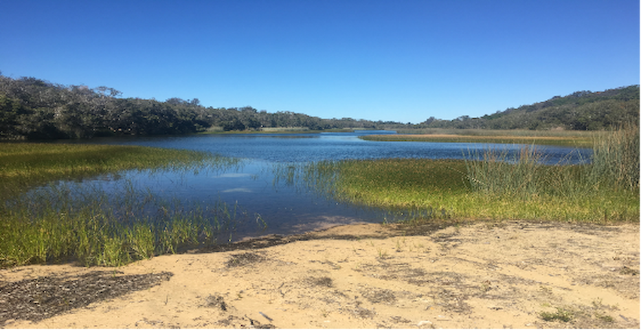
An incredible 4.5km series of clear freshwater lakes, commonly used for kayaking and stand-up-paddle boarding but equally fantastic for swimming. The Keyhole Lagoons are in a really quiet area with few visitors. You will need to drive along main beach to access the Keyhole Lagoons, which requires four wheel drive. Alternatively you can access them by walking approx 1 hour from George Nothling Drive
With 4WD: Permits are required and can be obtained from Straddie Camping You’ll also need to check tide times as driving on the beach is prohibited for two hours either side of low tide. Drive down the beach until you are parallel with the Keyhole Lagoons. Turn onto the access track then about 100m in to the first lagoon
106 persone del luogo consigliano
North Stradbroke Island
Keyhole Lagoons
An incredible 4.5km series of clear freshwater lakes, commonly used for kayaking and stand-up-paddle boarding but equally fantastic for swimming. The Keyhole Lagoons are in a really quiet area with few visitors. You will need to drive along main beach to access the Keyhole Lagoons, which requires four wheel drive. Alternatively you can access them by walking approx 1 hour from George Nothling Drive
With 4WD: Permits are required and can be obtained from Straddie Camping You’ll also need to check tide times as driving on the beach is prohibited for two hours either side of low tide. Drive down the beach until you are parallel with the Keyhole Lagoons. Turn onto the access track then about 100m in to the first lagoon
Carpark at the end of Timbinn Road with a walking track down to Deadmans Beach. Beach showers at the top of the track. A great place to explore the rock pools where you can see small fish, anemones and crabs. There are no lifesaving patrols on this beach.
Deadmans Headland Reserve
Timbin RoadCarpark at the end of Timbinn Road with a walking track down to Deadmans Beach. Beach showers at the top of the track. A great place to explore the rock pools where you can see small fish, anemones and crabs. There are no lifesaving patrols on this beach.
Scenic Walks
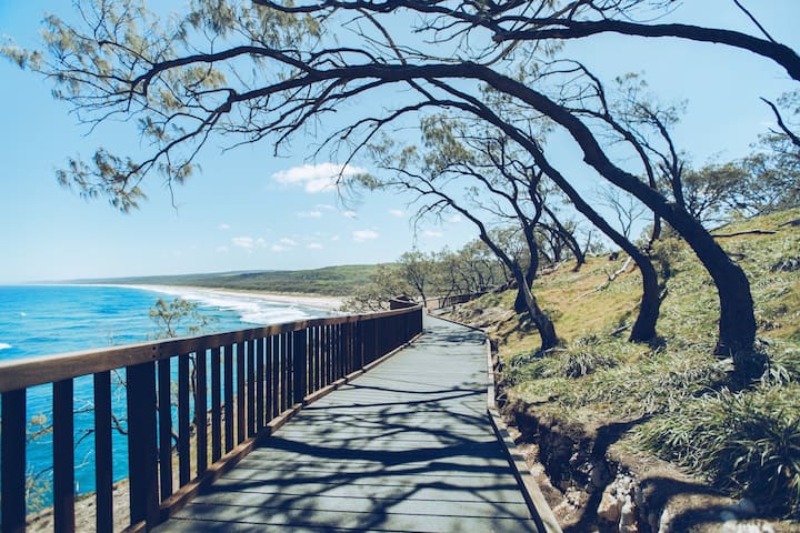
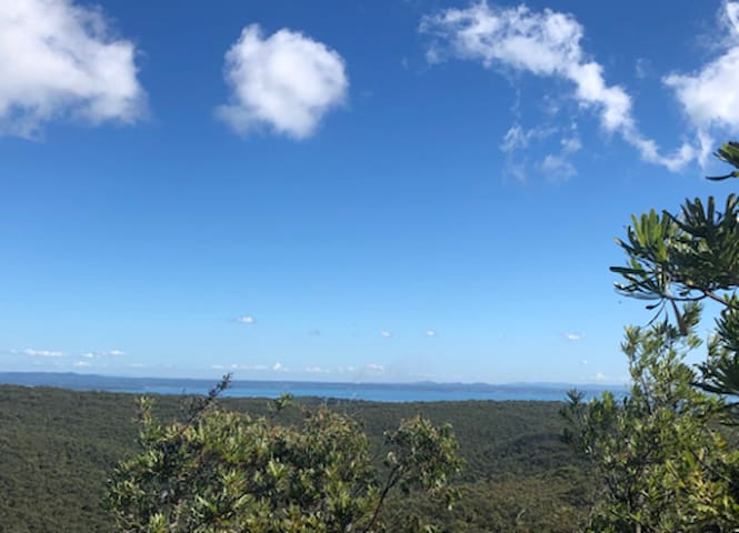
Straddie’s impressive headland walk called the North Gorge Walk is the best vantage point on the island to watch the whales and marine life pass right before your eyes. The North Gorge headland walk is a must do at Point Lookout. The walking track offers spectacular views across the South Pacific Ocean and is the perfect spot for viewing the abundance of marine life that frolic in the waters off the headland, turtles, dolphins and manta rays can be seen all year round, with the Humpback Whales making an appearance from June to November.
The walk encompasses the best of both worlds, with its raw and jagged headland to one side, and natural bushland on the other, The Gorge Walk also has a unique rock formation called the ‘Blow Hole’, similar to that of a humpback whale. Kangaroos are also frequently spotted in and around the walk, along with goannas and on occasion we have seen large blue tongue lizards. The Gorge Walk is a North Stradbroke Island icon and reveals just how pristine and unspoiled the island truly is. Access to the Gorge Walk is on Moloomba Road at Point Lookout, opposite the Oceanic Gelati Shop.
16 persone del luogo consigliano
Gorge Walk
Gorge WalkStraddie’s impressive headland walk called the North Gorge Walk is the best vantage point on the island to watch the whales and marine life pass right before your eyes. The North Gorge headland walk is a must do at Point Lookout. The walking track offers spectacular views across the South Pacific Ocean and is the perfect spot for viewing the abundance of marine life that frolic in the waters off the headland, turtles, dolphins and manta rays can be seen all year round, with the Humpback Whales making an appearance from June to November.
The walk encompasses the best of both worlds, with its raw and jagged headland to one side, and natural bushland on the other, The Gorge Walk also has a unique rock formation called the ‘Blow Hole’, similar to that of a humpback whale. Kangaroos are also frequently spotted in and around the walk, along with goannas and on occasion we have seen large blue tongue lizards. The Gorge Walk is a North Stradbroke Island icon and reveals just how pristine and unspoiled the island truly is. Access to the Gorge Walk is on Moloomba Road at Point Lookout, opposite the Oceanic Gelati Shop.
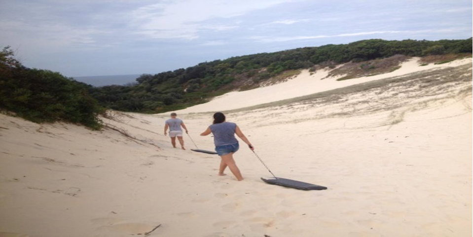
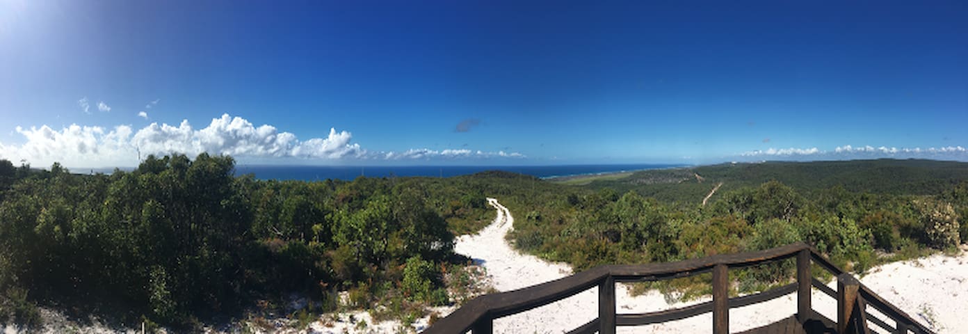
About 20 m further up the road from Surf Song on the left hand side is an access track, if you follow this track and take the right fork in the track after about 30 minutes there is a short climb, you will eventually come out at one of the highest points on the island. There is a large area of sand drifts which are perfect for sand surfing. Take the boogie boards and have fun sliding down the dunes. It can be quite hot in the middle of the day in summer so plan to go early or late and take water with you
Track
TrackAbout 20 m further up the road from Surf Song on the left hand side is an access track, if you follow this track and take the right fork in the track after about 30 minutes there is a short climb, you will eventually come out at one of the highest points on the island. There is a large area of sand drifts which are perfect for sand surfing. Take the boogie boards and have fun sliding down the dunes. It can be quite hot in the middle of the day in summer so plan to go early or late and take water with you
George Nothling Drive to Tripping Rock. About 50 metres up the road from Surf Song on the righthand side just before the end of the sealed road is an access track that goes uphill to Tripping Rock. There is a great view back to the club house and also down main beach.
George Nothling Drive
George Nothling DriveGeorge Nothling Drive to Tripping Rock. About 50 metres up the road from Surf Song on the righthand side just before the end of the sealed road is an access track that goes uphill to Tripping Rock. There is a great view back to the club house and also down main beach.
There are three walking tracks at Blue Lake
The yellow track is 5.2 km return, approximately 1.5–2 hours walking. Grade: easy. The walk to Karboora (means deep silent pool also known as Blue Lake) passes through wallum woodlands with stunted eucalypt trees, wallum banksias and a heath understorey. The edges of the lake are thickly vegetated with eucalypts, banksias and sedges, making it a haven for birds such as honeyeaters and lorikeets. The lake supports waterbirds, such as grebes and ducks, as well as several species of native freshwater fish including rainbowfish and gudgeons. Fortunate visitors may catch sight of a golden wallaby (Wallabia bicolor) —a form of swamp wallaby found only on Peel Island and North and South Stradbroke islands—or, on overcast days, hear the call of the near threatened Cooloola sedgefrog (Litoria coolooensis). This walk is an easy grade; however, the path is loose sand and can be hot in summer. Karboora is a place of significant cultural value to the Quandamooka people
18 persone del luogo consigliano
Blue Lake
There are three walking tracks at Blue Lake
The yellow track is 5.2 km return, approximately 1.5–2 hours walking. Grade: easy. The walk to Karboora (means deep silent pool also known as Blue Lake) passes through wallum woodlands with stunted eucalypt trees, wallum banksias and a heath understorey. The edges of the lake are thickly vegetated with eucalypts, banksias and sedges, making it a haven for birds such as honeyeaters and lorikeets. The lake supports waterbirds, such as grebes and ducks, as well as several species of native freshwater fish including rainbowfish and gudgeons. Fortunate visitors may catch sight of a golden wallaby (Wallabia bicolor) —a form of swamp wallaby found only on Peel Island and North and South Stradbroke islands—or, on overcast days, hear the call of the near threatened Cooloola sedgefrog (Litoria coolooensis). This walk is an easy grade; however, the path is loose sand and can be hot in summer. Karboora is a place of significant cultural value to the Quandamooka people
Walking Track from the Blue Lake Carpark
The green track climbs to the lookout at Mt Vane with great views in all directions including back to the mainland. There is less shade at the end of this track so it is best attempted early in the morning or in the cooler months.
Mount Vane
Walking Track from the Blue Lake Carpark
The green track climbs to the lookout at Mt Vane with great views in all directions including back to the mainland. There is less shade at the end of this track so it is best attempted early in the morning or in the cooler months.
Walking Track from the Blue Lake Carpark
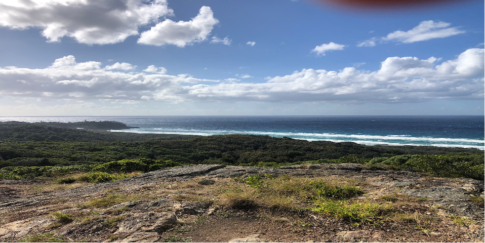
The red track climbs to a spectacular lookout down Main beach and the Seventeen Mile Swamp. The best direction allowing for views and incline is to take the red track from the carpark then circle back via blue and then yellow track.
Neembeeba Lookout
Walking Track from the Blue Lake Carpark
The red track climbs to a spectacular lookout down Main beach and the Seventeen Mile Swamp. The best direction allowing for views and incline is to take the red track from the carpark then circle back via blue and then yellow track.
Amenities and Services
Petrol Station and General Store
Location: 126 Dickson Way, Point Lookout
Phone(07) 3415 3347
Open: 7 days
Hours: 6am – 7pm Summer
Menu: Straddie Burger, Hot Chickens, Fish & Chips also Indian Curries
(Can pre-order on the phone)
Straddie Roadhouse
126 Dickson WayPetrol Station and General Store
Location: 126 Dickson Way, Point Lookout
Phone(07) 3415 3347
Open: 7 days
Hours: 6am – 7pm Summer
Menu: Straddie Burger, Hot Chickens, Fish & Chips also Indian Curries
(Can pre-order on the phone)
Beach 4 wheel driving.
Four wheel drive vehicles are required for driving on Flinders Beach and Main Beach.
A beach access permit must be purchased before driving on the beach. The 4WD beach permit is valid for 12 months and can be obtained at Adder Rock Campground
Be aware, the rules of the road apply to all beaches on Stradbroke. The speed limit on Flinders Beach is 40km/h Speed limit on Main Beach is 60 km/h
Access onto the beach and driving a vehicle on the beach one hour before and one hour after hide tide is not permitted.
High tide will be calculated from published tide times for Brisbane Bar with Flinders Beach and Main Beach (minus) 80 minutes. Visit www.more2redlands.com.au
Carry essential spares, spade, recovery strap, tyre gauge for deflating tyres.
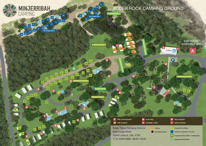
Adder Rock Camping Ground
East Coast RoadBeach 4 wheel driving.
Four wheel drive vehicles are required for driving on Flinders Beach and Main Beach.
A beach access permit must be purchased before driving on the beach. The 4WD beach permit is valid for 12 months and can be obtained at Adder Rock Campground
Be aware, the rules of the road apply to all beaches on Stradbroke. The speed limit on Flinders Beach is 40km/h Speed limit on Main Beach is 60 km/h
Access onto the beach and driving a vehicle on the beach one hour before and one hour after hide tide is not permitted.
High tide will be calculated from published tide times for Brisbane Bar with Flinders Beach and Main Beach (minus) 80 minutes. Visit www.more2redlands.com.au
Carry essential spares, spade, recovery strap, tyre gauge for deflating tyres.
Bob’s Shop – Foodworks 3409 8271
Convenience store – grocery items, kitchen ware, batteries, ice, fruit and vegetables
27 persone del luogo consigliano
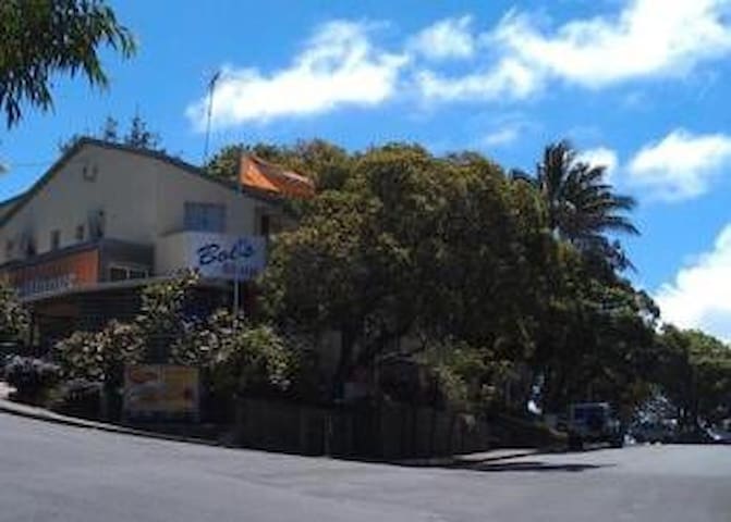
FoodWorks
8 Endeavour StBob’s Shop – Foodworks 3409 8271
Convenience store – grocery items, kitchen ware, batteries, ice, fruit and vegetables
Point Lookout Pharmacy. 3409 8661
Location:1/4 Kennedy Drive, Point Lookout (Next door to the Medical Centre)
Mon- Fri 9:00 am – 5:30 pm
Saturday 9:00am – 12:00 pm
6 persone del luogo consigliano
POINT LOOKOUT PHARMACY
4 Kennedy DrPoint Lookout Pharmacy. 3409 8661
Location:1/4 Kennedy Drive, Point Lookout (Next door to the Medical Centre)
Mon- Fri 9:00 am – 5:30 pm
Saturday 9:00am – 12:00 pm
The Green Room Mintee St
Fresh fruit and vegetables, specialty grocery and deli items.
16 persone del luogo consigliano
Green Room
27 Mooloomba RoadThe Green Room Mintee St
Fresh fruit and vegetables, specialty grocery and deli items.
07 3409 8188
Bar, bistro, bottle shop (in the underground car park) and day spa.
26 persone del luogo consigliano
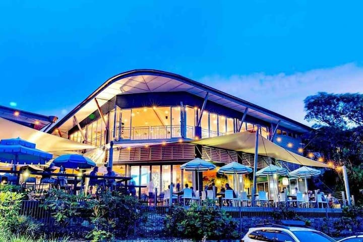
Stradbroke Island Beach Hotel
158 E Coast Rd07 3409 8188
Bar, bistro, bottle shop (in the underground car park) and day spa.
Sports Clubs
Location: Point Lookout Bowls Club, East Coast Rd, Point Lookout
Phone: (07) 3409 8182
Open: 7 days (seasonal) for Barefoot bowls
Hours: Lunch 11:30am – 2:00pm Dinner 5:30pm – 8:00pm
Menu: Bistro-style meals
Fully Licensed
16 persone del luogo consigliano
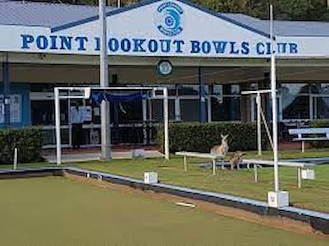
Point Lookout Bowls Club
75 Dickson WayLocation: Point Lookout Bowls Club, East Coast Rd, Point Lookout
Phone: (07) 3409 8182
Open: 7 days (seasonal) for Barefoot bowls
Hours: Lunch 11:30am – 2:00pm Dinner 5:30pm – 8:00pm
Menu: Bistro-style meals
Fully Licensed
Location: Kennedy Drive, Point Lookout
Phone: 0400 643 860
Open: Saturday & Sunday (varies seasonal)
Hours: From 3.00pm
Licensed
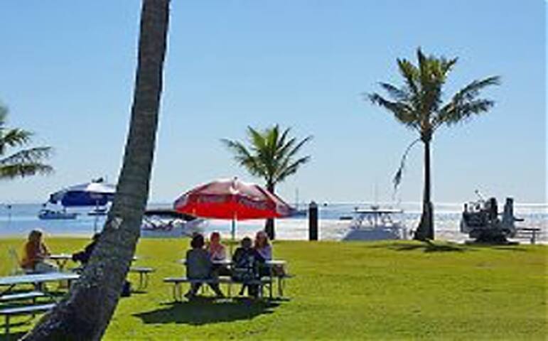
Spectacular views of the headlands, beaches and surfing
17 persone del luogo consigliano
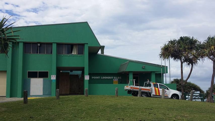
Point Lookout Surf Life Saving Club
24 Kennedy DrLocation: Kennedy Drive, Point Lookout
Phone: 0400 643 860
Open: Saturday & Sunday (varies seasonal)
Hours: From 3.00pm
Licensed
Spectacular views of the headlands, beaches and surfing
Location: Trans-Island Road, (Alfred Martin Way) Dunwich
Phone: (07) 3409 9999
Open: 7 days
Hours: 7am – 5pm (breakfast and lunch)
Menu: A la carte
Licensed
8 persone del luogo consigliano
North Stradbroke Island Golf Club
Alfred Martin WayLocation: Trans-Island Road, (Alfred Martin Way) Dunwich
Phone: (07) 3409 9999
Open: 7 days
Hours: 7am – 5pm (breakfast and lunch)
Menu: A la carte
Licensed
Location: Ron Stark Oval; Cnr Cunningham & Ballow Roads, Dunwich
Phone: (07) 3409 9216
Open: 7 Days
Hours: Lunch 12.00noon – 3.00pm / Dinner 6.00pm – 8.00pm
Menu: A la carte, bistro style meals, pizza and fresh locally caught fish Fully Licensed
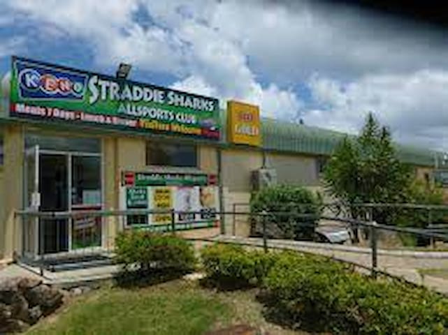
Straddie Shark's Allsports Club
2 Ballow RoadLocation: Ron Stark Oval; Cnr Cunningham & Ballow Roads, Dunwich
Phone: (07) 3409 9216
Open: 7 Days
Hours: Lunch 12.00noon – 3.00pm / Dinner 6.00pm – 8.00pm
Menu: A la carte, bistro style meals, pizza and fresh locally caught fish Fully Licensed
Location: Yabby Street Dunwich
Phone: (07) 3409 9022
Open: Lunch Wed – Sun, dinner Wed – Sat
Hours: Lunch 12:00noon – 2:00pm / Dinner 6:00pm – Till Late
Menu: Bistro style meals and bar snacks. Function bookings available
Fully Licensed
9 persone del luogo consigliano
Little Ship Club QLD
1 Yabby StLocation: Yabby Street Dunwich
Phone: (07) 3409 9022
Open: Lunch Wed – Sun, dinner Wed – Sat
Hours: Lunch 12:00noon – 2:00pm / Dinner 6:00pm – Till Late
Menu: Bistro style meals and bar snacks. Function bookings available
Fully Licensed
Location : Clayton Road Amity Point
Phone 3409 7110
Licenced club and Bistro Family playground
Mini golf and pool tables
Pokies, Keno and TAB
8 persone del luogo consigliano
Amity Point Community Club Inc.
Claytons RoadLocation : Clayton Road Amity Point
Phone 3409 7110
Licenced club and Bistro Family playground
Mini golf and pool tables
Pokies, Keno and TAB
Boating and Fishing
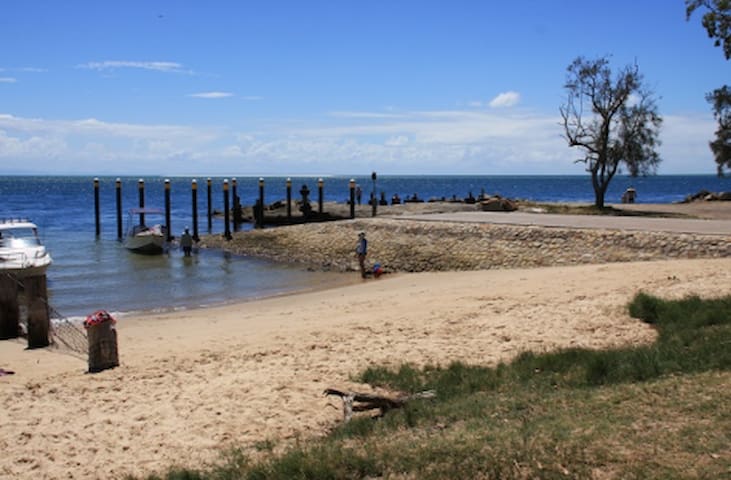
Amity Point Boat Ramp
Public Boat Ramp sheltered in winds NE to SE
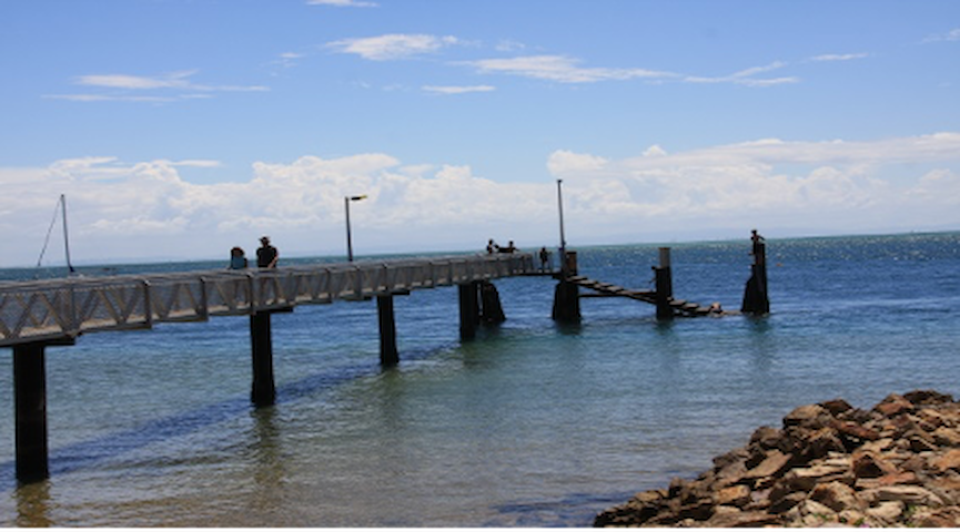
Amity Point Jetty
Fishing from the Amity Jetty
Boat Ramp
One Mile Boat Ramp
For smaller boats able to be launched off the beach, access is from the Flinders Beach 4WD road opposite Tramican St in Point Lookout. There is a small amount of protection afforded by the Adder Rock headland.> Beach Driving permit is required
Minjerribah Camping - Flinders Beach 4WD Access #3
142A East Coast RoadFor smaller boats able to be launched off the beach, access is from the Flinders Beach 4WD road opposite Tramican St in Point Lookout. There is a small amount of protection afforded by the Adder Rock headland.> Beach Driving permit is required
Consigli per viaggiatori
Muoversi in zona
Vehicle Ferry
Stradbroke Ferries run the Vehicle Ferry and bookings are essential. Contact Sealink Stradbroke Ferries on 07 3488 5300 for more information, or log on to www.sealinkseq.com.au for timetables and to book.
If you are connecting with the vehicle ferry you will need to arrive approximately 20 min prior to departure, the Vehicle Ferry takes 50 minutes and the arrival point on Straddie is at the Dunwich Ferry Terminal
Muoversi in zona
Passenger Ferries (allow plenty of time to find a carpark)
Stradbroke Ferries run a Passenger Ferry from Toondah Harbour called the Water Taxi. There is no need to book. The timetable is available on the Sealink website. The Water Taxi arrives at the Dunwich Ferry Terminal and takes approximately 25 minutes.
Gold Cats/Stradbroke Flyer is the other Passenger Ferry departing from Toondah Harbour, there is also no need to book and tickets can be purchased on board. Gold cats take about 25 minutes and arrives at the One Mile Jetty. Phone 3821 3821 for more information or log on to www.flyer.com.au for timetable.
Muoversi in zona
Straddie Bus
The North Stradbroke Island bus service connects with most of the Passenger ferry services on the island, dropping off at all the major beaches and tourism destinations. The Bus stop for Surf Song is George Nothling Drive. It takes approximately 25 minutes from Dunwich/One Mile to the George Nothling Drive Bus Stop.
Bus fare is cash only